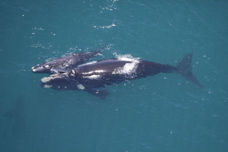
The southern right whale, Eubalaena australis, is correct in coming to the surface to be counted. It's always been the, "right whale," of course, but now satellites will help us to ensure this species' survival. Hopefully, all whales that come to the surface at all regularly can soon be included in surveys, so we can compensate for thee unforgiveable use of their blubber for oil lamps!
As the authors of Plos ONE's paper explain their mode of operation, the point is to discover, "how many are there?" To estimate a population manually is more or less impossible for inaccessible marine organisms. Whale impact on food webs and ecosystems is as enormous as their bulk in biomass. Because some species bask in the Sun's warmth, this animal's test was easier than with any other whale species to try out newly-developed satellite techniques for population analysis.
In the Southern Hemisphere winter, shallow coastal lagoons harbour the 7,500 whales in the northern part of their range. July to November is the period of "capture," utilising the calm and optimum visibility. In fact, only one image, on 19th September 2012, was used, showing the giant Golfo Nuevo lagoon. High densities of mothers were basking with their young, who will lose heat more rapidly. There were ancestral populations of 155,000 animals, hunted from the 16th century, bringing the population down to 300, in 3 populations. Mortality now, especially in Argentina has risen to 420, mainly calves in these nursery areas, in recent years.
The remote satellite system uses much higher resolution than previous cameras, and much lower financial resources! Even penguins and seals can we counted. The Worldview2 satellite even uses far blue in the spectrum to see underwater and perform hydrographic mapping (coastal bathymetry for the initiated). The resolution of the image showed about 2m per pixel, which means the whale takes up several. Whale pairs counted as mother and calf and even the typical head calluses can be identified (see our pic above).
Seabird groups were also identified on the coastal picture. Although their size discriminated against their identification as whales, this means automatic population estimate would be more difficult. The only other misidentification could be orcas. Their small size and lack of presence at this time helped in this picture, however. Given the close match of automatic detection with the team's manual whale counting, it seems likely that these possible errors would be negligible.
Behavioural patterns are next on the agenda for Peter T. Fretwell, Iain J. Staniland and Jaume Forcada of the British Antarctic Survey. They also suggest some whale species for other accurate population estimates and recommend forthcoming satellite platforms with even higher resolution of panchromatic images. This ground breaking or rather ocean-breaking paper appears in Whales from Space? under the open access aegis of PloS ONE.
The return of a Magnificent 7 right whales to New Zealand lagoons is recorded here as Right whales return to NZ.


