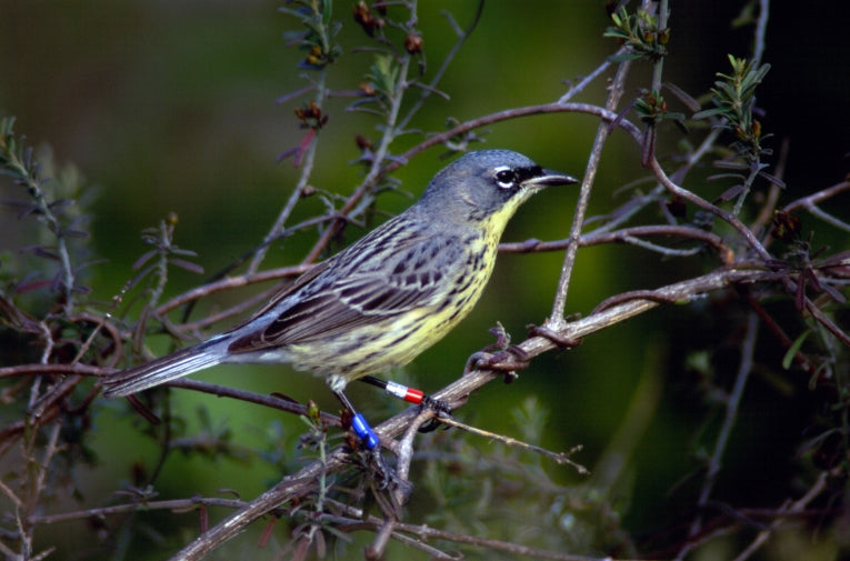
Burning trees might not seem an obvious environmental good but when, in the 1960s, American efforts to stamp out forest fires started to really succeed a tiny bird which depended on post-fire new growth for its woodland habitat was threatened. Now, in an effort to support the Kirtland's warbler, conservationists are using satellites and controlled burns as part of their armoury.
A small bird with a distinctive yellow belly, Kirtland's warblers spend their summers in the United States before wintering in the Bahamas.
By 1967, the US Fish and Wildlife Service had the bird on its endangered list as fire prevention measures succeeded across parts of Michigan, Wisconsin and Ontario and saw the warblers decrease in number by more than 50 per cent in under a decade.
In the US, action was taken to protect the birds: cowbirds that competed for food were tacked and controlled burning helped provide the young growth forests the warblers love. It was a success and by 1995 numbers were three times higher.
However, scientists wanted to see how the warblers' winter quarters were fairing and set their satellite sites on Eleuthera, an island in the Bahamas.
They used Landsat to survey the island - making multiple observations to build up a picture of what was going on under the tropical cloud cover.
Their research is published in the new issue of Biotropica and says Landsat Team member from the United States Geological Survey Eileen Helmer it confirms that similar conditions need to be maintained in both winter and summer homes.
Helmer's team built up a 30 year picture of the conditions on the ground and found that any disturbance to the forest was good news for the warblers, whether it came from land clearance, accidental fire damage or just grazing. In fact, letting goats loose on established forest cleared undergrowth and made the perfect home for the birds.
The researchers were able to create an historic series of images by using both Landsat and the Advance Land Imager sensor on board Earth-Observing 1.
Landsat is a programme of both NASA and the US Geological Survey and has been keeping an eye on the planet since 1972.
This survey is the best yet to show human impact on forests whose age and height are closely related and the techniques used could be useful in other similar situations: Landsat covers most of the globe and its date is made freely available. Helmer is due to report on her work on mapping the heights of forests at the American Geophysical Union conference on Friday, December 9 in San Francisco.


