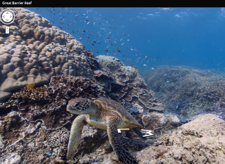
The Caitlin Seaview Survey is a large scientific survey of most reefs in the ocean. Using the data and images they have, it is now possible to explore them. We love to dive into our coral problems and reef fauna in Earth Times.
On this auspicious day, Google have released several panoramas which let you see exactly what our scuba and diver friends see with the help of this huge amount of survey material..
On Google maps, which we all have, everyone can survey the colour and the vistas. "With these vibrant and stunning photos you don't have to be a scuba diver - or even know how to swim - to explore and experience six of the ocean's most incredible living coral reefs," says Brian McClendon, Vice President of Google Maps and Earth, believably.
As they claim, "now, anyone can become the next virtual Jacques Cousteau and dive with sea turtles, fish and manta rays in Australia, the Philippines and Hawaii."
The Barrier Reef is Australian, of course, while Apo Island in the Philppines has ancient boulder corals still alive. Hawaii has the spectacular underwater crater at Maui or Hanauma bay near Oahu. And you can go anywhere on earth on the maps of course and have a dabble wherever you like.
Putting your own pics in the map would be useful but don't expect to compete with those panoramic cameras the surveying scientists are using.
However, personally, I think the latest digital cameras' capabilities are really worth checking out, as science needs information from everybody to help maintain these ecosystems at this time of rightly-anticipated problems . All is not well with our oceans. The more we photograph, the more we can see those problems.


