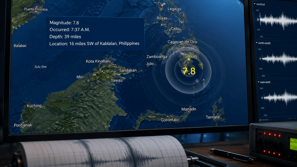
The southern Philippines faced a catastrophic start to the week on Monday morning. At 7:37 a.m. local time, a massive magnitude 7.8 earthquake ruptured off the coast of Mindanao, bringing widespread destruction and immediate tsunami threats to the archipelago. The violent seismic event centered approximately 16 miles southwest of Kablalan in Sarangani province at a shallow depth of roughly 10 to 22 kilometers. The intense ground shaking collapsed multi-story buildings, sheared through critical infrastructure, and triggered devastating landslides in rural communities, leaving at least 32 people dead and more than 100 injured.
Philippine Institute of Volcanology and Seismology (PHIVOLCS) director Teresito Bacolcol warned residents that severe aftershocks would follow the main tremor. He urged citizens to stay clear of weakened structures. Emergency response teams mobilized instantly, struggling through debris-choked roads to reach the hardest-hit zones around the major port city of General Santos. The scope of the destruction is still coming into focus as communication networks slowly come back online across the island, revealing splintered roads and flattened neighborhoods.
The Tsunami Threat and Coastal Evacuations
The sheer force of the seafloor displacement immediately triggered international tsunami protocols. The Pacific Tsunami Warning Center issued urgent alerts for coastal areas spanning from the Philippines to Indonesia and Malaysia. Initial forecasts modeled potential wave heights reaching up to three meters crashing into the Philippine coastline.
Coastal residents faced terrifying moments as sirens blared and local authorities commanded immediate evacuations to higher ground. Philippine President Ferdinand Marcos Jr. released an emergency statement directing citizens to prioritize their lives over material possessions. The swift evacuation orders proved necessary for survival. Ocean sensors confirmed that waves measuring roughly one meter eventually slammed into several southern coastal villages. The surging seawater breached defensive seawalls, flooded low-lying coastal roads, and submerged dozens of fishing boats anchored near the shore.
The ripple effect of the displaced water extended far beyond local shores. Smaller tsunami waves triggered monitoring stations in Taiwan, Japan, Guam, and Papua New Guinea. Authorities in those regions remained on high alert, closely tracking tide gauges to confirm local harbors and marinas stayed safe from unpredictable surges. The Pacific Ocean’s interconnected nature means a localized seafloor collapse off Mindanao can alter tidal patterns thousands of miles away, putting entire island nations on defensive footing.
| Affected Region | Tsunami Warning Status | Observed Wave Impact |
| Southern Philippines | Immediate Evacuation Ordered | ~1-meter waves reported in coastal villages |
| Indonesia / Malaysia | High Alert Issued | Minor tidal fluctuations recorded |
| Japan / Taiwan / Guam | Regional Advisories Posted | Nominal wave height anomalies detected |
| Hawaii / U.S. West Coast | Evaluated | No threat determined |
Assessing the Structural Toll and Human Cost
As the ocean settled, the grim reality on land became apparent. General Santos, a sprawling commercial hub heavily reliant on the tuna export industry, suffered severe structural failures. Low-rise commercial buildings buckled under the sustained lateral shaking. Local hospitals received a steady influx of patients suffering from blunt force trauma, lacerations, and crush injuries sustained from falling masonry. Power grids failed across multiple provinces, leaving millions without electricity or reliable access to fresh water.
The rural municipalities surrounding the epicenter faced a different kind of horror. In the mountainous town of Glan, the intense vibrations destabilized saturated slopes, triggering a massive landslide that buried dozens of homes. Disaster-mitigation officials confirmed that at least 13 villagers perished under the mud and debris in that single incident. Rescue operations in Glan remain highly perilous. The ground is unstable, and subsequent aftershocks—several registering at magnitude 6.0 or higher—continue to shift the earth, forcing first responders to retreat periodically to avoid secondary collapses. Heavy machinery operator crews are working around the clock to clear the main arteries connecting these isolated towns to urban medical centers.
International support started materializing by Monday afternoon. The U.S. Geological Survey provided real-time seismic data to help local agencies predict aftershock patterns. Diplomatic missions from the United States, France, Japan, and New Zealand extended offers of humanitarian aid, deploying search-and-rescue specialists and heavy lifting equipment to assist the overstretched Philippine disaster management agencies.
The Tectonic Reality of an Archipelago
The Philippines occupies a highly volatile segment of the planet’s crust. It sits squarely on the Pacific “Ring of Fire,” a 25,000-mile horseshoe-shaped basin characterized by relentless tectonic collisions. In this particular region, the Philippine Sea Plate continuously grinds against and subducts beneath the Sunda Plate. This immense geological friction builds stress over decades or centuries before violently releasing it in a matter of seconds.
Monday’s earthquake stands as the strongest seismic event to hit the nation this year. The shallow depth of the rupture meant the seismic energy had very little distance to travel before hitting the surface, amplifying the destructive shaking felt by millions of residents. The physical mechanics of how tectonic plates interact along deep-ocean trenches dictate that these massive subduction zone quakes will remain a permanent fixture of life in Southeast Asia.
Urban planners and structural engineers in the Philippines face a monumental challenge. They must design cities capable of absorbing sudden, violent kinetic energy. Strict building codes exist, but enforcement remains inconsistent in rural or economically disadvantaged areas. When a magnitude 7.8 earthquake strikes, those inconsistencies translate directly into structural failure and lost lives.
The recovery phase in Mindanao will take months, if not years. Rebuilding the devastated communities of Sarangani province requires more than just clearing the rubble. It demands a renewed commitment to seismic resilience, making certain that future infrastructure can withstand the inevitable tremors generated by the restless tectonic fault lines lurking just off the coast.