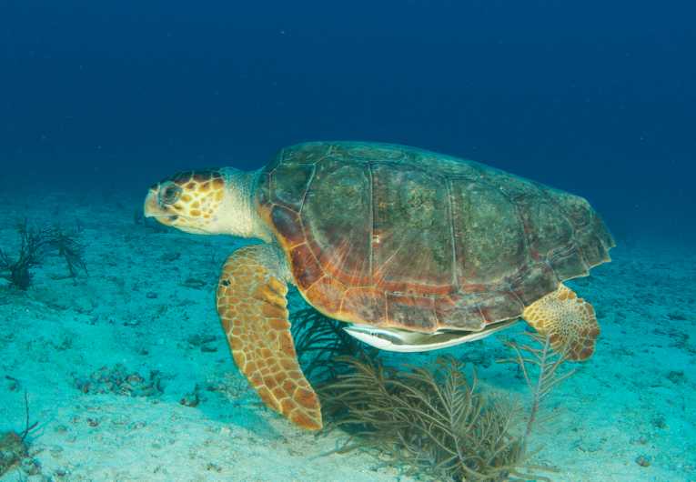
Two new feeding 'hotspots' of the endangered loggerhead sea turtle (Caretta caretta) have been discovered by scientists using satellite tags to track their movements. A study paper published in the journal Biological Conservation also points out that these two feeding locations, both in the Gulf of Mexico, are supporting several populations of loggerheads.
Found by analysing sateliite tracking data, it is thought that at least three populations are supported by the two 'hotspots' of vital loggerhead habitat. One is located north of the Yukatan Peninsula and the other off Southwest Florida. The scientists examined the satellite tracking data from three different loggerhead populations to find where they feed and travel throughout the Gulf of Mexico. The data will then be used to help habitat conservation planning for the long suffering species.
Logerhead turtle numbers have been in decline in the Gulf and they face varied and numerous threats; these include bycatch from trawling, longline and gillnet fishing. The researchers hope discovering these new feeding areas will provide more insight into how these turtles live while at sea.
Research ecologist and lead scientist, Kristen Hart, Ph.D., from the U.S. Geological Survey said:
"Up until now, management actions that affect loggerheads have often focused on their limited time at nesting beaches, or on fisheries regulations."
"Our findings open up important new options for marine habitat conservation, and provide valuable geographic data that can be used to strategically locate marine reserves based on the best available science, as called for in the new National Ocean Policy."
Female loggerhead turtles were fitted with satellite tracking equipment after nesting at various locations, the Florida Panhandle, Casey Key and Dry Tortugas National Park. The reseachers used these satellite 'tags' to track their movements and timescale throughout their migration to the two newly discovered feeding areas. Three loggerhead females migrated to the Yukatan feeding area and seven turtles travelled to the location off Southwest Florida.
The researchers used a new system to synthesise the tag tracking data and this confirmed earlier theories that turtles from the three distinct populations frequently used these two locations of critical habitat. It is hoped that the findings of the research may help predict where loggerheads feed and help with species conservation efforts.
"The use of satellite tags for tracking marine animals has opened our eyes to the secret lives of some of nature's most elusive creatures," said USGS director Marcia McNutt, "At first a scientific tool to understand the life cycle of animals, such as white sharks and leatherback turtles, who rarely come into contact with humans, these tags may now be the main hope for understanding what we can do, or what we should stop doing, in order to bring them back from the road to extinction."
"The logical next step is to investigate what makes these particular sites 'prime' foraging grounds by mapping and sampling the habitat types found on the sea floor. It would also be useful to tag loggerheads at these foraging sites to confirm how long they reside in these areas, or alternatively to see where they go next."
The full research paper, 'Common coastal foraging areas for loggerheads in the Gulf of Mexico: Opportunities for marine conservation' is available via the journal Biological Conservation.


