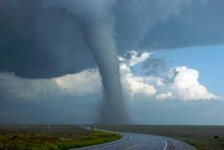
The rising mercury in thermometers across southern US states, on Friday March 2nd, was an ominous sign. As a warm humid wedge of air piled north from the Gulf of Mexico, triggering 28 highest temperature records across US states - from Arkansas and Alabama, to Georgia and Kentucky - the weather-watchers were worried. All the ingredients for a tornado super-outbreak were in place. And by dark on March 3rd, 36-hours later, more than 100 tornadoes had gouged a devastating trail across the American South and Midwest. Thirty-nine people were dead, and the US had suffered one of the deadliest opening salvos to its 'tornado season'.
The 2nd-3rd March 2012 tornado super-outbreak spawned at least eleven powerful EF3 tornadoes - with winds from 136 to 165mph - and one monster EF4 tornado. That bought 175mph winds, and total destruction, to four towns across Indiana. Twelve deaths were reported from Henrysville, Indiana, the highest death toll of the outbreak. A terrible human tragedy, to be sure, but one to ascribe to the awesome-but-random power of nature. Or is it?
Take some heat, mix in some cold, add a dash of 'wind shear'
The unusual early start to this year's tornado season , after an exceptionally mild winter, together with last year's record-breaking tornado havoc, has left some asking - is there something pushing tornadoes outbreaks to greater extremes? Could global warming be that factor? That's something scientists are not certain on. But the science of tornado-formation and climate change powerfully suggest that tornadoes won't be standing still, as the globe warms. As the climate alters, the way tornadoes react will change too - with unforeseen consequences for those found in their path.
Tornadoes are the ultimate 'storm-with-attitude', which form when three conditions come together, high in the airs flowing over places like the US. First there needs to be a source of heat. The Gulf of Mexico provided that last week, with its waters 1°C above average, as this winter ends. Then that warm air has to be pushed beneath a colder, dryer air mass. This makes the atmosphere unstable, as the lower warm air rises and the cold air sinks - triggering the eddies and pools that form energetic storms, or supercells.
And that was what happened last Friday, with the Gulf's warm-air pulsing northwards, spilled over by colder air from Canada pushing south. Finally, you need to turn the updraft of these vigorous thunderstorms into the whirling, twisting air mass of a tornado. That happens when the wind changes speed and direction quickly with height - the so-called wind shear. Just such a rapid change in wind direction, on the 2nd and 3rd of March, is what turned a rash of nasty thunderstorms into so many vicious tornadoes.
Time to factor in global warming?
The reason for climate scientists' uncertainty, on how global warming will affect tornadoes, is that rising temperatures may act on those 'ingredients' in different ways. So the future shape of tornadoes is hard to predict. Higher temperature makes it likely that the 'seed' thunderstorms will be more intense, so producing larger tornadoes. But a warming world also affects how winds vary through the different layers of the atmosphere. The lowest levels are warming faster than air higher up, so scientists reckon there will be less 'wind shear'. With less wind shear to twist storms to tornadoes, there could be fewer of them.
A 2007 study that involved Robert Trapp, from Purdue University, saw the 'higher energy' effect outweighing the reduced 'wind shear' side from global warming. More tornadoes for the MidWest from March to May; and more for the eastern US from June to August - that is how Trapp's paper saw things evolving, in a warmed North America. But other scientists, such as Anthony Del Genio, of GISS (Goddard Institute for Space Studies) think that the lowered wind shear will win out - producing fewer but bigger storms.
Another scientist, Jonathan Martin, from University of Wisconsin-Madison, sees the potential for storms increasing, because of another effect - more frequent 'superjets', made up of merged jet streams. These jet streams are high-altitude bands of wind which whip around the planet at up to 150mph. Normally there is a polar jet stream closer to the Arctic, and a separate tropical jet stream, closer to the Tropics. But sometimes they merge into a superjet - which is exactly what happened on Friday. Martin believes that global warming will make such merged superjets more likely.
Tornadoes on the superjet freight-train
One of the most dangerous aspects of last week's outbreak was the speed that the tornadoes were traveling. Many of the tornadoes cutting through Kentucky were pegged at 70-mph, while some storms were clocked doing over 80mph. These storms were being driven forward by the wind speed at high-altitude - right where the superjet was hitting over 115mph. If Martin is right, with more superjets, tornadoes could get faster too, as the planet heats.
Whatever the future holds out, things are already changing for many in America's 'tornado-alley' - insurance costs. After nursing a $26 billion payout from 2011 - when a record number of twisters earned it the moniker 'The Year of the Tornado' - the US insurance industry is reported to be looking to raise rates; more so after 2012's inauspicious start. Only time will tell whether 2012 turns out to be 'Year of the Tornado II'; and whether global warming has more sequels planned for the unfortunate American public.


